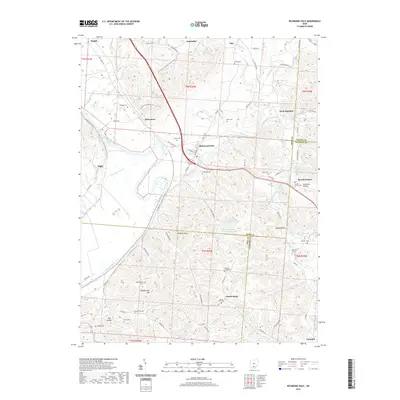
2019 Map of Richmond Dale
USGS Topo · Published 2019About this map
Richmond Dale serves as the central hub of this Ross County landscape, situated where the Scioto River valley meets the complex drainages of Salt Creek and Lick Run. The map reveals a high density of ancestral burial grounds, including the Little Mound Cem and Beals Cem near the town center, and the German Chapel Cem tucked into the southern hills. Industrial activity is evident near the Scioto River through the Southern Silica Pond Number One, while the rugged southern terrain is defined by prominent heights like Weddington Hill and Mount Sinai. Regional transport is anchored by Vigo Rd and the N Country National Scenic Trail, which traverses the ridge lines above Rittenours. This survey documents a rural Ohio corridor defined by small settlements and the persistent family landmarks of the 19th-century hill country.
Find a feature on this map
84 named features on this map. Tap any name to fly to it.
Don’t see what you’re looking for? This feature index may not catch every label — zoom into the map to look around manually.
Map Details
Editions of this 2019 Richmond Dale Map
This is the sole edition of this map. No revisions or reprints were ever made.
Other maps of this area

1906 · Waverly
USGS Topo · 1:62,500

1906 · Chillicothe
USGS Topo · 1:62,500

1908 · Chillicothe
USGS Topo · 1:62,500

1908 · Waverly
USGS Topo · 1:62,500

1910 · Laurelville
USGS Topo · 1:62,500

1912 · Laurelville
USGS Topo · 1:62,500

1913 · Jackson
USGS Topo · 1:62,500

1944 · Jackson
USGS Topo · 1:62,500

1944 · Laurelville
USGS Topo · 1:62,500

1947 · Columbus
USGS Topo · 1:250,000