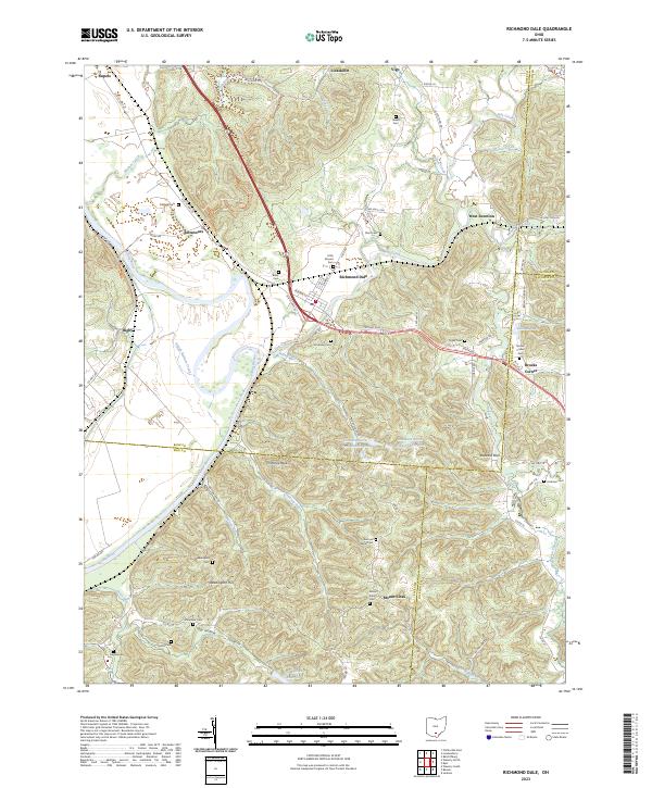
2023 Map of Richmond Dale
USGS Topo · Published 2023About this map
Richmond Dale sits at a geographic crossroads in Ross County, where the valley of Salt Creek meets the wide corridor of the Scioto River. The landscape is defined by the sharp transition from river bottoms to the dissected uplands of southern Ohio, featuring prominent geological landmarks like Chimney Rocks and Buzzard Rock. The area's settlement history is etched into the hillsides through numerous small burial grounds such as German Chapel Cem, Stockman Cem, and Weddington Cem, many located near old township roads and family-named features like Weddington Hill.
Find a feature on this map
91 named features on this map. Tap any name to fly to it.
Don’t see what you’re looking for? This feature index may not catch every label — zoom into the map to look around manually.
Map Details
Editions of this 2023 Richmond Dale Map
This is the sole edition of this map. No revisions or reprints were ever made.
Other maps of this area

1906 · Waverly
USGS Topo · 1:62,500

1906 · Chillicothe
USGS Topo · 1:62,500

1908 · Chillicothe
USGS Topo · 1:62,500

1908 · Waverly
USGS Topo · 1:62,500

1910 · Laurelville
USGS Topo · 1:62,500

1912 · Laurelville
USGS Topo · 1:62,500

1913 · Jackson
USGS Topo · 1:62,500

1944 · Jackson
USGS Topo · 1:62,500

1944 · Laurelville
USGS Topo · 1:62,500

1947 · Columbus
USGS Topo · 1:250,000