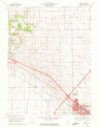
1970 Map of Rising
USGS Topo · Published 1972About this map
The Kankakee Ridge defines the topography of this Illinois prairie landscape, where the headwaters of the Sangamon River and Kaskaskia River originate within miles of each other. At the dawn of the 1970s, the rural character of Hensley and Mahomet townships met the expanding northern limits of Champaign City. The map documents a transition from agricultural land, marked by numerous family and community burial grounds like Jersey Cem and Phillippe Cem, to modern infrastructure including the Sewage Disposal Ponds and a complex highway network. Along the Penn Central rail line, the small settlement of Rising persists amidst a terrain shaped by glacial legacy. Significant recreational and civic spaces are also captured, from the established Lake of the Woods Park to the developing neighborhoods near Garden Hills Park.
Find a feature on this map
45 named features on this map. Tap any name to fly to it.
Don’t see what you’re looking for? This feature index may not catch every label — zoom into the map to look around manually.
Map Details
Editions of this 1970 Rising Map
3 editions found
Other maps of this area

1906 · Urbana
USGS Topo · 1:62,500

1907 · Mahomet
USGS Topo · 1:62,500

1924 · Paxton
USGS Topo · 1:62,500

1927 · Paxton
USGS Topo · 1:62,500

1928 · Gibson City
USGS Topo · 1:62,500

1949 · Paxton
USGS Topo · 1:62,500

1957 · Urbana
USGS Topo · 1:62,500

1957 · Paxton
USGS Topo · 1:62,500

1957 · Gibson City
USGS Topo · 1:62,500

1957 · Urbana
USGS Topo · 1:24,000