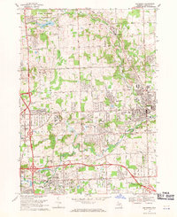
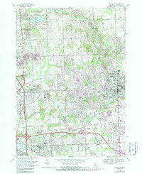
1968 Map of Rochester
USGS Topo · Published 1971About this map
The Clinton River corridor anchors this 1968 study of a rapidly developing area in Oakland County, where suburban expansion meets legacy institutional landmarks and industry. The city of Rochester is a central hub, flanked by the sprawling campuses of Oakland University and Michigan Christian College. To the south, Auburn Heights and the growing residential tracts near Oakland Community College show the shift from rural landscapes toward more dense urban planning.
Find a feature on this map
64 named features on this map. Tap any name to fly to it.
Don’t see what you’re looking for? This feature index may not catch every label — zoom into the map to look around manually.
Map Details
Editions of this 1968 Rochester Map
5 editions found
Other maps of this area

1907 · Pontiac
USGS Topo · 1:62,500

1908 · Rochester
USGS Topo · 1:62,500

1936 · Warren
USGS Topo · 1:31,680

1936 · Birmingham
USGS Topo · 1:31,680

1936 · Rochester
USGS Topo · 1:31,680

1936 · Washington
USGS Topo · 1:31,680

1936 · Pontiac South
USGS Topo · 1:31,680

1936 · Pontiac North
USGS Topo · 1:31,680

1943 · Pontiac South
USGS Topo · 1:24,000

1943 · Pontiac North
USGS Topo · 1:24,000
Featured Places
- Rochester Hills, MI
- Pontiac, MI
- Orion Charter Township, MI
- Auburn Hills, MI
- Oakland Charter Township, MI