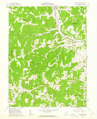
1961 Map of Rockbridge
USGS Topo · Published 1963About this map
The Hocking River valley serves as the central corridor for this 1961 survey, where the Chesapeake and Ohio railroad tracks parallel the water through Sugar Grove and Rockbridge. The landscape is characterized by a dense concentration of family and community cemeteries, such as the Old Catholic Cem, McBroom Cem, and Whippoorwill Cem, which reflect the long-standing rural settlements established along the ridges and hollows.
Find a feature on this map
45 named features on this map. Tap any name to fly to it.
Don’t see what you’re looking for? This feature index may not catch every label — zoom into the map to look around manually.
Map Details
Editions of this 1961 Rockbridge Map
Other maps of this area

1904 · Zaleski
USGS Topo · 1:62,500

1907 · Zaleski
USGS Topo · 1:62,500

1907 · Logan
USGS Topo · 1:62,500

1907 · Lancaster
USGS Topo · 1:62,500

1909 · Lancaster
USGS Topo · 1:62,500

1909 · Logan
USGS Topo · 1:62,500

1910 · Laurelville
USGS Topo · 1:62,500

1912 · Laurelville
USGS Topo · 1:62,500

1944 · Laurelville
USGS Topo · 1:62,500

1947 · Columbus
USGS Topo · 1:250,000