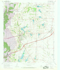
1963 Map of Rockwall
USGS Topo · Published 1969About this map
Rockwall serves as the focal point of this 1960s landscape, positioned just as significant water management projects were reshaping the Texas Blackland Prairies. The western edge is defined by the burgeoning Lake Ray Hubbard along the East Fork Trinity River, a feature that would fundamentally alter the local geography and recreation. The map captures the interaction between old transport routes and new infrastructure, showing the Missouri Kansas Texas railroad line and an Old Railroad Grade alongside more modern developments like the Rockwall Airport.
Find a feature on this map
39 named features on this map. Tap any name to fly to it.
Don’t see what you’re looking for? This feature index may not catch every label — zoom into the map to look around manually.
Map Details
Editions of this 1963 Rockwall Map
4 editions found
Other maps of this area

1891 · Dallas
USGS Topo · 1:125,000

1893 · Dallas
USGS Topo · 1:125,000

1912 · Rockwall
USGS Topo · 1:31,680

1919 · Royse City
USGS Topo · 1:62,500

1924 · Farmersville 3-c
USGS Topo · 1:48,000

1924 · Mc Kinney 4-d
USGS Topo · 1:48,000

1929 · McKinney
USGS Topo · 1:62,500

1930 · Farmersville
USGS Topo · 1:62,500

1954 · Dallas
USGS Topo · 1:250,000

1954 · Sherman
USGS Topo · 1:250,000