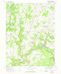
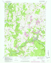
1968 Map of Rockwood
USGS Topo · Published 1975About this map
The Casselman River winds through the southern portion of this Somerset County landscape, anchoring a corridor of industry and transit in the late 1960s. The town of Rockwood serves as a focal point where the Baltimore and Ohio and Western Maryland railroads converge near the Rockwood Station. This intersection of rail lines highlights the historical importance of the river valley for heavy transport, supported by infrastructure like a Pumping Station and local Strip Mine operations scattered across the township of Milford.
Find a feature on this map
49 named features on this map. Tap any name to fly to it.
Don’t see what you’re looking for? This feature index may not catch every label — zoom into the map to look around manually.
Map Details
Editions of this 1968 Rockwood Map
5 editions found
Other maps of this area

1913 · Somerset
USGS Topo · 1:62,500

1915 · Somerset
USGS Topo · 1:62,500

1921 · Meyersdale
USGS Topo · 1:62,500

1922 · Confluence
USGS Topo · 1:62,500

1922 · Donegal
USGS Topo · 1:62,500

1931 · Confluence
USGS Topo · 1:62,500

1933 · Confluence
USGS Topo · 1:62,500

1935 · Donegal
USGS Topo · 1:62,500

1939 · Meyersdale
USGS Topo · 1:62,500

1944 · Somerset
USGS Topo · 1:62,500