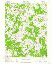
1961 Map of Rodney
USGS Topo · Published 1963About this map
Raccoon Creek meanders through Gallia County, carving a valley that anchors the small settlements of Northup, Cora, and Rodney. In the early 1960s, this landscape was defined by its transition from agricultural valley floors to upland ridges like Kriner Ridge and the heights of Poplar Knob. The mapping captures a network of rural life, featuring country churches such as Providence Ch and Fairfield Ch, alongside numerous small family and community cemeteries including Hulbert Cem and Rose Cem.
Find a feature on this map
82 named features on this map. Tap any name to fly to it.
Don’t see what you’re looking for? This feature index may not catch every label — zoom into the map to look around manually.
Map Details
Editions of this 1961 Rodney Map
Other maps of this area

1906 · Bidwell
USGS Topo · 1:62,500

1906 · Athalia
USGS Topo · 1:62,500

1906 · Glenwood
USGS Topo · 1:62,500

1908 · Bidwell
USGS Topo · 1:62,500

1908 · Athalia
USGS Topo · 1:62,500

1908 · Glenwood
USGS Topo · 1:62,500

1908 · Point Pleasant
USGS Topo · 1:62,500

1926 · Point Pleasant
USGS Topo · 1:62,500

1929 · Point Pleasant
USGS Topo · 1:62,500

1957 · Huntington
USGS Topo · 1:250,000