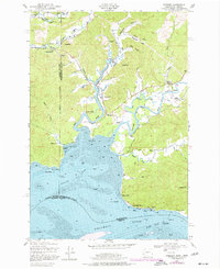
1949 Map of Rosburg
USGS Topo · Published 1977About this map
The tidal waters of Grays Bay and the Columbia River define this stretch of the Pacific Northwest, where the shifting sands of the Miller Sands Channel meet the rugged timberlands of Wahkiakum and Pacific counties. Settlement patterns follow the winding paths of the Deep River and Grays River, with small communities like Rosburg and Oneida situated near the riverbanks. The local economy in the mid-20th century is evidenced by a power station and the Cannery Light, reflecting the importance of maritime navigation and industry along the waterfront.
Find a feature on this map
53 named features on this map. Tap any name to fly to it.
Don’t see what you’re looking for? This feature index may not catch every label — zoom into the map to look around manually.
Map Details
Editions of this 1949 Rosburg Map
3 editions found

Other maps of this area

1919 · Astoria
USGS Topo · 1:62,500

1938 · Fort Columbia
USGS Topo · 1:62,500

1939 · Astoria
USGS Topo · 1:62,500

1940 · Svensen
USGS Topo · 1:62,500

1940 · Brookfield
USGS Topo · 1:62,500

1943 · Fort Columbia
USGS Topo · 1:62,500

1949 · Astoria
USGS Topo · 1:24,000

1949 · Upper Naselle River
USGS Topo · 1:24,000

1949 · Oman Ranch
USGS Topo · 1:24,000

1949 · Knappton
USGS Topo · 1:24,000