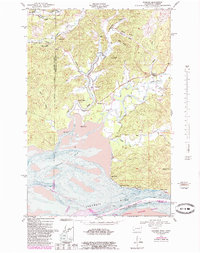
1949 Map of Rosburg
USGS Topo · Published 1985About this map
The tidal landscape of the lower Columbia River dominates this mid-century survey, where the river's interaction with the Grays Bay shoreline defines the local geography. Settlements such as Rosburg and Eden are connected by a network of waterways and sloughs, including Rangila Slough and Seal Slough. The map documents critical infrastructure of the era, from the Rosburg School and a Power station to maritime landmarks like Svensens Landing and Carlson Landing.
Find a feature on this map
41 named features on this map. Tap any name to fly to it.
Don’t see what you’re looking for? This feature index may not catch every label — zoom into the map to look around manually.
Map Details
Editions of this 1949 Rosburg Map
3 editions found

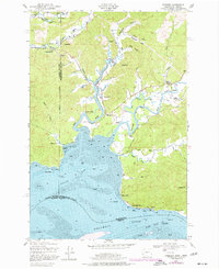
Other maps of this area

1919 · Astoria
USGS Topo · 1:62,500

1938 · Fort Columbia
USGS Topo · 1:62,500

1939 · Astoria
USGS Topo · 1:62,500

1940 · Svensen
USGS Topo · 1:62,500

1940 · Brookfield
USGS Topo · 1:62,500

1943 · Fort Columbia
USGS Topo · 1:62,500

1949 · Astoria
USGS Topo · 1:24,000

1949 · Upper Naselle River
USGS Topo · 1:24,000

1949 · Oman Ranch
USGS Topo · 1:24,000

1949 · Knappton
USGS Topo · 1:24,000