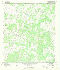
1967 Map of Round Mountain
USGS Topo · Published 1969About this map
Round Mountain stands as the central landmark of this Hill Country landscape, situated at the intersection of route 281 and Highway 962. The terrain is defined by its complex drainage network, where the headwaters of North Cypress Creek and Cypress Creek carve through the limestone-rich topography. To the east, the settlement of Cypress Mill marks a local node of activity near the confluence of Cleveland Branch and the main creek.
Find a feature on this map
24 named features on this map. Tap any name to fly to it.
Don’t see what you’re looking for? This feature index may not catch every label — zoom into the map to look around manually.
Map Details
Editions of this 1967 Round Mountain Map
2 editions found
Other maps of this area

1887 · Blanco
USGS Topo · 1:125,000

1887 · Burnet
USGS Topo · 1:125,000

1893 · Burnet
USGS Topo · 1:125,000

1894 · Blanco
USGS Topo · 1:125,000

1903 · Burnet
USGS Topo · 1:125,000

1909 · Burnet
USGS Topo · 1:125,000

1925 · Burnet 3-d
USGS Topo · 1:48,000

1929 · Marble Falls
USGS Topo · 1:62,500

1931 · Marble Falls
USGS Topo · 1:48,000

1932 · Marble Falls
USGS Topo · 1:62,500