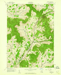
1945 Map of Roxbury
USGS Topo · Published 1960About this map
The East Branch Delaware River carves a narrow, vital corridor through the high terrain of the Catskills, serving as the primary conduit for the New York Central railroad. This mid-century landscape is defined by small, family-named settlements perched in mountain hollows and narrow valleys, reflecting a long-established pattern of high-elevation farming and industry. Concentrated activity centers on the town of Roxbury and the hub at Grand Gorge, while more remote communities like Moffit Settlement and West Settlement dot the surrounding slopes.
Find a feature on this map
35 named features on this map. Tap any name to fly to it.
Don’t see what you’re looking for? This feature index may not catch every label — zoom into the map to look around manually.
Map Details
Editions of this 1945 Roxbury Map
4 editions found
Other maps of this area

1900 · Phoenicia
USGS Topo · 1:62,500

1901 · Margaretville
USGS Topo · 1:62,500

1901 · Gilboa
USGS Topo · 1:62,500

1903 · Gilboa
USGS Topo · 1:62,500

1903 · Phoenicia
USGS Topo · 1:62,500

1904 · Hobart
USGS Topo · 1:62,500

1904 · Margaretville
USGS Topo · 1:62,500

1945 · West Kill
USGS Topo · 1:24,000

1945 · Gilboa
USGS Topo · 1:24,000

1945 · Fleischmanns
USGS Topo · 1:24,000