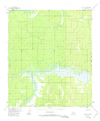
1952 Map of Ruby B-1
USGS Topo · Published 1975About this map
The Titna River carves a complex, meandering path across this interior Alaskan landscape, defining the central geography of the Ruby region as it appeared in the early 1950s. The river is surrounded by extensive wetlands and swampy lowlands, with the Telstina River and Big Mud River contributing to a dense hydrologic network. These waterways were the primary conduits for travel and subsistence in an era before established road networks reached this portion of the territory. Evidence of seasonal or remote habitation is found at Cabins along the northern banks of the Titna, likely serving as trapper or hunter outposts. The eastern edge of the map is defined by the Kateel River Meridian, while Baker Creek drains the southeastern corner, reflecting the remote and largely unpopulated character of the Yukon-Koyukuk frontier during the mid-twentieth century.
Find a feature on this map
7 named features on this map. Tap any name to fly to it.
Don’t see what you’re looking for? This feature index may not catch every label — zoom into the map to look around manually.
Map Details
Editions of this 1952 Ruby B-1 Map
3 editions found
Other maps of this area

1948 · Kantishna River
USGS Topo · 1:250,000

1951 · Kantishna River
USGS Topo · 1:250,000

1951 · Ruby
USGS Topo · 1:250,000

1952 · Ruby A-2
USGS Topo · 1:63,360

1952 · Ruby B-1
USGS Topo · 1:63,360

1952 · Ruby B-2
USGS Topo · 1:63,360

1952 · Ruby A-1
USGS Topo · 1:63,360

1952 · Ruby C-1
USGS Topo · 1:63,360

1952 · Kantishna River C-6
USGS Topo · 1:63,360

1952 · Ruby C-2
USGS Topo · 1:63,360