
1952 Map of Ruby D-4
USGS Topo · Published 1957About this map
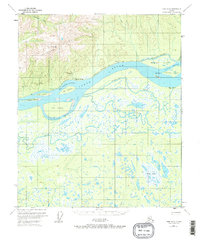
The Yukon River dominates this interior landscape, carving a wide path between the steep Kokrines Hills to the north and a dense network of wetlands to the south. Near the settlement of Kokrines, an Abandoned Telegraph Line follows the northern riverbank, marking a former communication corridor through the wilderness. The river's dynamic nature is evident in the complex system of secondary channels and islands, such as Junekakat Slough, Ham Island, and Hardluck Island.
Find a feature on this map
35 named features on this map. Tap any name to fly to it.
Don’t see what you’re looking for? This feature index may not catch every label — zoom into the map to look around manually.
Map Details
Editions of this 1952 Ruby D-4 Map
This is the sole edition of this map. No revisions or reprints were ever made.
Other maps of this area

1951 · Ruby
USGS Topo · 1:250,000

1951 · Melozitna
USGS Topo · 1:250,000

1952 · Ruby D-5
USGS Topo · 1:63,360

1952 · Ruby C-3
USGS Topo · 1:63,360

1952 · Ruby C-5
USGS Topo · 1:63,360

1952 · Ruby D-3
USGS Topo · 1:63,360

1952 · Ruby C-4
USGS Topo · 1:63,360

1952 · Ruby
USGS Topo · 1:250,000

1953 · Melozitna A-4
USGS Topo · 1:63,360
1953 · Ruby D-4
USGS Topo · 1:63,360