
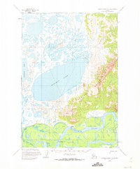
1954 Map of Russian Mission C-4
USGS Topo · Published 1962About this map
Kalskag and Lower Kalskag anchor this 1950s survey, situated along the north bank of the sweeping Kuskokwim River. The landscape is defined by an intricate network of wetlands and tundra lakes, dominated by the expansive waters of Arhymot Lake and Kukaklik Lake. To the east, the terrain rises sharply into the Portage Mountains, where survey markers like VABM 464 Martin denote the high ground overlooking the river valley.
Find a feature on this map
13 named features on this map. Tap any name to fly to it.
Don’t see what you’re looking for? This feature index may not catch every label — zoom into the map to look around manually.
Map Details
Editions of this 1954 Russian Mission C-4 Map
2 editions found
Other maps of this area

1947 · Russian Mission
USGS Topo · 1:250,000

1950 · Russian Mission
USGS Topo · 1:250,000

1952 · Russian Mission D-3
USGS Topo · 1:63,360

1952 · Russian Mission C-3
USGS Topo · 1:63,360

1952 · Russian Mission D-4
USGS Topo · 1:63,360

1952 · Russian Mission C-5
USGS Topo · 1:63,360
1952 · Russian Mission D-5
USGS Topo · 1:63,360

1952 · Russian Mission B-3
USGS Topo · 1:63,360

1954 · Russian Mission B-5
USGS Topo · 1:63,360

1954 · Russian Mission B-4
USGS Topo · 1:63,360