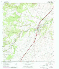
1964 Map of Salado
USGS Topo · Published 1987About this map
The waters of Salado Creek wind through the heart of Bell County, defining a landscape that shifted significantly during the 1960s. The northern edge of this survey is dominated by the nascent Stillhouse Hollow Lake, showing the area near its Spillway Elev 622 and the controlled inundation zones that altered the local topography. In the village of Salado, researchers can find the High Sch and Salado Cem, while further south, the settlement of Prairie Dell sits along the primary highway corridor.
Find a feature on this map
21 named features on this map. Tap any name to fly to it.
Don’t see what you’re looking for? This feature index may not catch every label — zoom into the map to look around manually.
Map Details
Editions of this 1964 Salado Map
3 editions found
Other maps of this area

1885 · Taylor
USGS Topo · 1:125,000

1887 · Taylor
USGS Topo · 1:125,000

1892 · Temple
USGS Topo · 1:125,000

1893 · Georgetown
USGS Topo · 1:125,000

1894 · Gatesville
USGS Topo · 1:125,000

1894 · Taylor
USGS Topo · 1:125,000

1924 · Gatesville 4-d
USGS Topo · 1:48,000

1924 · Temple 3-C
USGS Topo · 1:48,000

1930 · Killeen
USGS Topo · 1:62,500

1931 · Belton
USGS Topo · 1:62,500