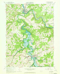
1964 Map of Saltsburg
USGS Topo · Published 1972About this map
Saltsburg sits at the confluence where the Conemaugh River and Loyalhanna Creek join to form the Kiskiminetas River. This early 1960s landscape is defined by the massive impoundment of the Loyalhanna Dam, creating a vast water body that reached into the Loyalhanna and Derry townships. The map documents a region in transition, where the Pennsylvania railroad lines and an Old Railroad Grade trace the movement of goods alongside active Strip Mine operations and a Quarry. Local social centers are well-preserved in this record, from the Kiskiminetas Spring Sch near the river to the Union Cem and Fenneltown Ch. Small settlements like Moween, White, and Tunnelton appear as they were before modern development, while the southern edge of the quadrangle shows the established borough of New Alexandria and the recreational grounds of Keystone State Park.
Find a feature on this map
45 named features on this map. Tap any name to fly to it.
Don’t see what you’re looking for? This feature index may not catch every label — zoom into the map to look around manually.
Map Details
Editions of this 1964 Saltsburg Map
3 editions found
Other maps of this area

1900 · Latrobe
USGS Topo · 1:62,500

1902 · Latrobe
USGS Topo · 1:62,500

1902 · Elders Ridge
USGS Topo · 1:62,500

1903 · Latrobe
USGS Topo · 1:62,500

1904 · Elders Ridge
USGS Topo · 1:62,500

1904 · Greensburg
USGS Topo · 1:62,500

1906 · Greensburg
USGS Topo · 1:62,500

1907 · Freeport
USGS Topo · 1:62,500

1909 · Freeport
USGS Topo · 1:62,500

1953 · Pittsburgh
USGS Topo · 1:250,000
Featured Places
- White, Conemaugh Township
- Saltsburg, PA
- New Alexandria, Derry Township
- Bell Township, PA
- Salem Township, PA