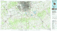
1985 Map of San Antonio
USGS Topo · Published 1992About this map
The metropolitan core of San Antonio is flanked by an extensive network of military installations in the mid-1980s, emphasizing the city's role as a major defense hub. Major facilities such as Lackland Air Force Base, Kelly Air Force Base, and the Fort Sam Houston Military Reservation dominate the landscape, while smaller enclaves like Alamo Heights and Terrell Hills are visible within the urban sprawl. Outside the loop of Interstate 410, the terrain transitions to the water-managed systems of Calaveras Lake and Braunig Lake, supporting the region's infrastructure.
Find a feature on this map
133 named features on this map. Tap any name to fly to it.
Don’t see what you’re looking for? This feature index may not catch every label — zoom into the map to look around manually.
Map Details
Editions of this 1985 San Antonio Map
3 editions found
Other maps of this area

1911 · San Marcos
USGS Topo · 1:125,000

1919 · San Marcos
USGS Topo · 1:125,000

1920 · Smiley
USGS Topo · 1:125,000

1924 · New Braunfels No 4
USGS Topo · 1:48,000

1924 · San Marcos 3-c
USGS Topo · 1:48,000

1925 · Tordia No. 1
USGS Topo · 1:48,000

1927 · New Braunfels
USGS Topo · 1:62,500

1927 · Pearsall
USGS Topo · 1:62,500

1930 · Seguin
USGS Topo · 1:62,500

1931 · Falls City
USGS Topo · 1:62,500