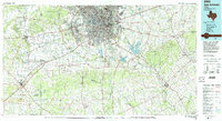
1985 Map of San Antonio
USGS Topo · Published 1992About this map
The San Antonio metropolitan landscape is defined by its massive Cold War-era military footprint and the convergence of major transit corridors in the mid-1980s. Large-scale installations like Fort Sam Houston Military Reservation, Kelly Air Force Base, and Lackland Air Force Base anchor the urban core, illustrating the city's strategic importance to national defense. Beyond the suburban growth of Leon Valley and Alamo Heights, the terrain transitions into the creek-fed ranch lands and farming communities of eastern Bexar and Wilson Counties. The map reveals the critical water management systems of the era, notably the cooling reservoirs of Calaveras Lake and Braunig Lake, while the historic San Antonio River and Medina River meander southward. Long-standing rural settlements such as Saint Hedwig, Sutherland Springs, and Floresville appear as distinct pockets of history along the Southern Pacific rail lines.
Find a feature on this map
117 named features on this map. Tap any name to fly to it.
Don’t see what you’re looking for? This feature index may not catch every label — zoom into the map to look around manually.
Map Details
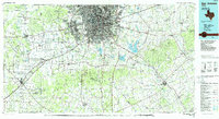
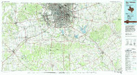
Editions of this 1985 San Antonio Map
3 editions found
Other maps of this area

1911 · San Marcos
USGS Topo · 1:125,000

1919 · San Marcos
USGS Topo · 1:125,000

1920 · Smiley
USGS Topo · 1:125,000

1924 · New Braunfels No 4
USGS Topo · 1:48,000

1924 · San Marcos 3-c
USGS Topo · 1:48,000

1925 · Tordia No. 1
USGS Topo · 1:48,000

1927 · New Braunfels
USGS Topo · 1:62,500

1927 · Pearsall
USGS Topo · 1:62,500

1930 · Seguin
USGS Topo · 1:62,500

1931 · Falls City
USGS Topo · 1:62,500