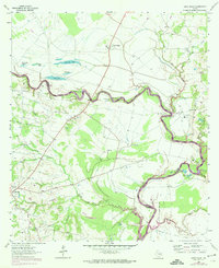
1964 Map of Sand Ridge
USGS Topo · Published 1974About this map
The Trinity River snakes along the boundary of Houston and Madison counties, defining a landscape shaped by shifting watercourses and early Texas agricultural history. In the early 1970s, the lower reaches of this survey show the encroaching waters of Lake Livingston, which dramatically altered the river basin. To the south, the extensive Eastham State Prison Farm occupies the fertile bottomlands near Negro Creek.
Find a feature on this map
34 named features on this map. Tap any name to fly to it.
Don’t see what you’re looking for? This feature index may not catch every label — zoom into the map to look around manually.
Map Details
Editions of this 1964 Sand Ridge Map
3 editions found
Other maps of this area

1953 · Palestine
USGS Topo · 1:250,000

1954 · Beaumont
USGS Topo · 1:250,000

1957 · Beaumont
USGS Topo · 1:250,000

1957 · Palestine
USGS Topo · 1:250,000

1962 · Connor
USGS Topo · 1:24,000

1962 · Wyser Bottom
USGS Topo · 1:24,000

1962 · Baker Lake
USGS Topo · 1:24,000

1964 · Sand Ridge
USGS Topo · 1:24,000

1964 · Austonio
USGS Topo · 1:24,000

1964 · Pearsons Chapel
USGS Topo · 1:24,000