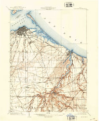
1904 Map of Sandusky
USGS Topo · Published 1941About this map
Sandusky and the surrounding shores of Lake Erie dominate this turn-of-the-century topographic landscape, where the bustling port city meets the waters of Sandusky Bay. The map reveals a dense network of early transportation, including the Baltimore and Ohio (Sandusky Branch) and the extensive Lake Shore Electric railway system. Along the coastline, the slender reach of Cedar Pt and the inland waters of Johnson Island define the harbor's geography.
Find a feature on this map
50 named features on this map. Tap any name to fly to it.
Don’t see what you’re looking for? This feature index may not catch every label — zoom into the map to look around manually.
Map Details
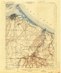
Editions of this 1904 Sandusky Map
3 editions found
Other maps of this area

1901 · Put-In-Bay
USGS Topo · 1:62,500

1901 · Bellevue
USGS Topo · 1:62,500

1903 · Bellevue
USGS Topo · 1:62,500

1903 · Vermilion
USGS Topo · 1:62,500

1903 · Put In Bay
USGS Topo · 1:62,500

1904 · Sandusky
USGS Topo · 1:62,500

1908 · New London
USGS Topo · 1:62,500

1915 · Norwalk
USGS Topo · 1:62,500

1915 · Siam
USGS Topo · 1:62,500

1916 · Kelleys Island
USGS Topo · 1:62,500