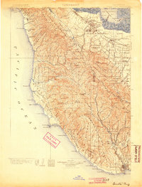
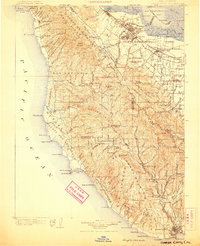
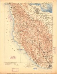
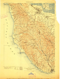
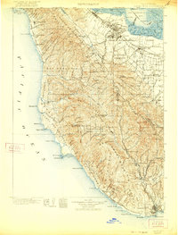
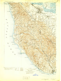
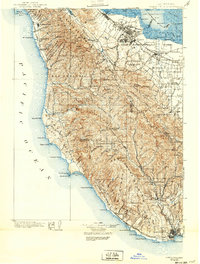
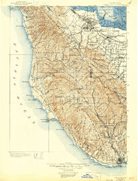
1902 Map of Santa Cruz
USGS Topo · Published 1904About this map
Stanford University and the emerging towns of the Peninsula define the northern reaches of this survey, where the Southern Pacific R. R. connects early hubs like Menlo Park and Palo Alto. Along the rugged coastline, isolated coastal communities such as Pescadero, San Gregorio, and Purisima are linked by winding roads across the steep ridges of Arroyo de la Purisima and El Corte de Madera. The central portion of the sheet is dominated by the wild terrain of the Big Basin and the heights of Ben Lomond Mountain.
Find a feature on this map
142 named features on this map. Tap any name to fly to it.
Don’t see what you’re looking for? This feature index may not catch every label — zoom into the map to look around manually.
Map Details
Editions of this 1902 Santa Cruz Map
9 editions found
Other maps of this area

1889 · San Jose
USGS Topo · 1:62,500

1892 · San Mateo
USGS Topo · 1:62,500

1896 · San Mateo
USGS Topo · 1:62,500

1897 · San Jose
USGS Topo · 1:62,500

1897 · Palo Alto
USGS Topo · 1:62,500

1899 · San Jose
USGS Topo · 1:62,500

1899 · Palo Alto
USGS Topo · 1:62,500

1899 · Haywards
USGS Topo · 1:62,500

1899 · San Mateo
USGS Topo · 1:62,500

1902 · Santa Cruz
USGS Topo · 1:125,000