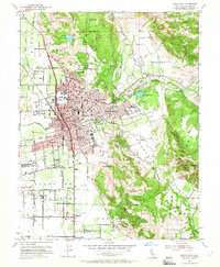
1954 Map of Santa Rosa
USGS Topo · Published 1965About this map
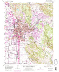
Santa Rosa centers this mid-century survey, revealing a post-war cityscape bounded by the rising terrain of Taylor Mtn and the Sonoma Valley. The city's civic core is clearly defined, featuring the Courthouse, City Hall, and the Luther Burbank Gardens. Beyond the urban grid, the map illustrates the era's educational and institutional growth through numerous local schools like Herbert Slater Jr High Sch and the Jr College. Transport and industry are marked by the Northwestern Pacific line and an inactive Naval Auxiliary Air Station south of town. Notable for genealogists, the sheet preserves the locations of several burial grounds, including the Rural Cemetery and Odd Fellows Cem, alongside landmarks such as the Bennett Valley Grange Hall and the Hillcrest Detention Home tucked into the foothills.
Find a feature on this map
78 named features on this map. Tap any name to fly to it.
Don’t see what you’re looking for? This feature index may not catch every label — zoom into the map to look around manually.
Map Details
Editions of this 1954 Santa Rosa Map
6 editions found
Other maps of this area

1916 · Santa Rosa
USGS Topo · 1:62,500

1920 · Healdsburg
USGS Topo · 1:62,500

1927 · Calistoga
USGS Topo · 1:62,500

1933 · Healdsburg
USGS Topo · 1:48,000

1935 · Sebastopol
USGS Topo · 1:48,000

1940 · Healdsburg
USGS Topo · 1:62,500

1942 · Sebastopol
USGS Topo · 1:62,500

1943 · Calistoga
USGS Topo · 1:62,500

1944 · Santa Rosa
USGS Topo · 1:62,500

1945 · Calistoga
USGS Topo · 1:62,500
Featured Places
- Santa Rosa, CA
- Bellevue, Santa Rosa
- Melita, Santa Rosa
- Larkfield-Wikiup, CA
- South Santa Rosa, Santa Rosa