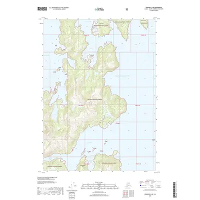
2018 Map of Seward B-2 NW
USGS Topo · Published 2018About this map
The Otter Creek Portage Trail traverses the center of this maritime landscape within the Chugach National Forest, connecting the sheltered waters of Otter Lake to the intricate coastlines of Prince William Sound. The terrain is defined by a series of deep bays and narrow inlets, including Louis Bay and Herring Bay to the north, and the branching reaches of the Bay of Isles to the south. This coastal topography, where Disk Island and Sphinx Island stand as sentinels near Lower Passage, illustrates a landscape where land and water are inextricably linked. Inland, small freshwater bodies like Solf Lake sit at the base of steep slopes, marking a transition from the tidal Salt Cove to the interior forest. The mapping of landmarks such as Manning Rocks and Foul Pass underscores the navigational hazards inherent to this part of the Alaska coastline.
Find a feature on this map
26 named features on this map. Tap any name to fly to it.
Don’t see what you’re looking for? This feature index may not catch every label — zoom into the map to look around manually.
Map Details
Editions of this 2018 Seward B-2 NW Map
This is the sole edition of this map. No revisions or reprints were ever made.
Other maps of this area

1950 · Seward B-3
USGS Topo · 1:63,360

1951 · Seward
USGS Topo · 1:250,000

1951 · Seward B-2
USGS Topo · 1:63,360

1951 · Seward C-3
USGS Topo · 1:63,360

1951 · Seward C-2
USGS Topo · 1:63,360

1952 · Seward B-3
USGS Topo · 1:63,360

1952 · Seward C-3
USGS Topo · 1:63,360

1952 · Seward B-2
USGS Topo · 1:63,360

1952 · Seward C-2
USGS Topo · 1:63,360

1953 · Seward
USGS Topo · 1:250,000