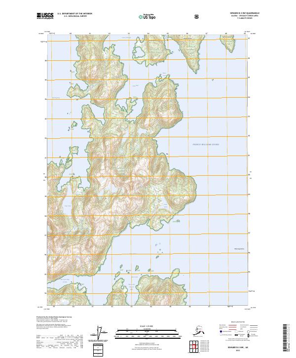
2023 Map of Seward B-2 NW
USGS Topo · Published 2023About this map
Prince William Sound dominates this coastal survey, where the intricate shoreline of Knight Island and its surrounding archipelago is meticulously documented. The landscape is defined by deep inlets and protected passages, such as the Lower Passage and the convoluted Bay of Isles. Inland, the terrain within the Chugach National Forest rises sharply from the sea, containing isolated freshwater bodies like Solf Lake and Otter Lake. One of the few marked signs of human passage through this wilderness is the Otter Lake Portage Trl, indicating a traditional route between the island's interior waters and the coast. The map also captures the maritime hazards and landmarks of the sound, including the Manning Rocks and numerous small landmasses like Disk Island, Ingot Island, and Sphinx Island.
Find a feature on this map
27 named features on this map. Tap any name to fly to it.
Don’t see what you’re looking for? This feature index may not catch every label — zoom into the map to look around manually.
Map Details
Editions of this 2023 Seward B-2 NW Map
This is the sole edition of this map. No revisions or reprints were ever made.
Other maps of this area

1950 · Seward B-3
USGS Topo · 1:63,360

1951 · Seward
USGS Topo · 1:250,000

1951 · Seward B-2
USGS Topo · 1:63,360

1951 · Seward C-3
USGS Topo · 1:63,360

1951 · Seward C-2
USGS Topo · 1:63,360

1952 · Seward B-3
USGS Topo · 1:63,360

1952 · Seward C-3
USGS Topo · 1:63,360

1952 · Seward B-2
USGS Topo · 1:63,360

1952 · Seward C-2
USGS Topo · 1:63,360

1953 · Seward
USGS Topo · 1:250,000