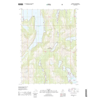
2018 Map of Seward B-4 NE
USGS Topo · Published 2018About this map
Prince William Sound dominates this coastal Alaska landscape, carving deep into the mainland with features like Blue Fiord and McClure Bay. The territory is almost entirely contained within the Chugach National Forest, where the topography shifts abruptly from sea level to the heights of Saddle Peak. This 2018 survey reveals a network of freshwater systems just inland from the saltwater bays, most notably the Jackpot Lakes and Eshamy Lake complexes.
Find a feature on this map
20 named features on this map. Tap any name to fly to it.
Don’t see what you’re looking for? This feature index may not catch every label — zoom into the map to look around manually.
Map Details
Editions of this 2018 Seward B-4 NE Map
This is the sole edition of this map. No revisions or reprints were ever made.
Other maps of this area

1950 · Seward B-3
USGS Topo · 1:63,360

1951 · Seward
USGS Topo · 1:250,000

1951 · Seward B-4
USGS Topo · 1:63,360

1951 · Seward C-4
USGS Topo · 1:63,360

1951 · Seward C-3
USGS Topo · 1:63,360

1952 · Seward B-4
USGS Topo · 1:63,360

1952 · Seward B-3
USGS Topo · 1:63,360

1952 · Seward C-3
USGS Topo · 1:63,360

1952 · Seward C-4
USGS Topo · 1:63,360

1953 · Seward
USGS Topo · 1:250,000