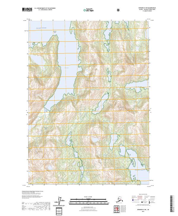
2023 Map of Seward B-4 NE
USGS Topo · Published 2023About this map
Chugach National Forest encompasses the entirety of this coastal Alaskan landscape, where the tides of the Pacific Ocean meet steep coastal topography. The intricate shoreline is defined by deep inlets like Blue Fiord and McClure Bay, which provided sheltered waters long before modern navigation aids. Inland, the map reveals a complex system of interconnected waterways and freshwater bodies, including the Jackpot Lakes and the sprawling Ewan Lake. These features, along with the drainage of Jackpot Creek, illustrate the hydrologic patterns of a wilderness that remains largely roadless and primitive. High-altitude landmarks like Saddle Peak and coastal hazards such as Procession Rocks near Division Point highlight the navigational challenges and physical landmarks essential to local travel and resource management in this maritime environment.
Find a feature on this map
18 named features on this map. Tap any name to fly to it.
Don’t see what you’re looking for? This feature index may not catch every label — zoom into the map to look around manually.
Map Details
Editions of this 2023 Seward B-4 NE Map
This is the sole edition of this map. No revisions or reprints were ever made.
Other maps of this area

1950 · Seward B-3
USGS Topo · 1:63,360

1951 · Seward
USGS Topo · 1:250,000

1951 · Seward B-4
USGS Topo · 1:63,360

1951 · Seward C-4
USGS Topo · 1:63,360

1951 · Seward C-3
USGS Topo · 1:63,360

1952 · Seward B-4
USGS Topo · 1:63,360

1952 · Seward B-3
USGS Topo · 1:63,360

1952 · Seward C-3
USGS Topo · 1:63,360

1952 · Seward C-4
USGS Topo · 1:63,360

1953 · Seward
USGS Topo · 1:250,000