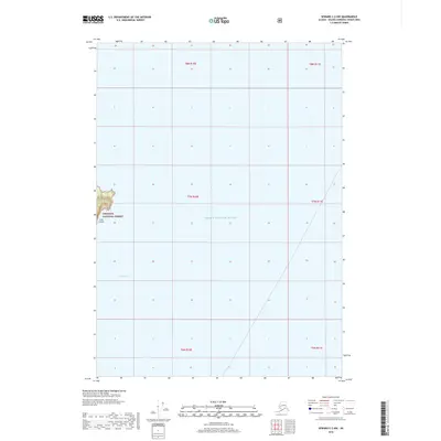
2018 Map of Seward C-2 NW
USGS Topo · Published 2018About this map
Prince William Sound dominates this maritime survey, showcasing a vast expanse of open water and coastal topography within the Chugach National Forest. The map captures the isolation of Lone Island on the western edge of the quadrangle, where steep elevation contours rise sharply from the shoreline to a central peak. To the south, the sheltered waters of South Bay indent the coast, offering a rare point of protection along an otherwise exposed marine landscape. This 2018 edition is primarily a hydrographic and wilderness record, showing the absence of developed infrastructure or settlements in this remote Alaskan borough. Instead, the sheet focuses on precise coastal boundaries and the intersection of the National Forest with the unorganized territory's coastline.
Find a feature on this map
10 named features on this map. Tap any name to fly to it.
Don’t see what you’re looking for? This feature index may not catch every label — zoom into the map to look around manually.
Map Details
Editions of this 2018 Seward C-2 NW Map
This is the sole edition of this map. No revisions or reprints were ever made.
Other maps of this area

1951 · Seward
USGS Topo · 1:250,000

1951 · Seward D-2
USGS Topo · 1:63,360

1951 · Seward D-3
USGS Topo · 1:63,360

1951 · Seward C-3
USGS Topo · 1:63,360

1951 · Seward C-2
USGS Topo · 1:63,360

1952 · Seward D-3
USGS Topo · 1:63,360

1952 · Seward C-3
USGS Topo · 1:63,360

1952 · Seward C-2
USGS Topo · 1:63,360

1952 · Seward D-2
USGS Topo · 1:63,360

1953 · Seward
USGS Topo · 1:250,000