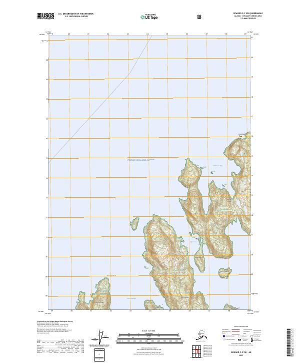
2023 Map of Seward C-2 SW
USGS Topo · Published 2023About this map
Prince William Sound dominates this coastal landscape, surrounding an intricate network of islands and narrow waterways within the Chugach National Forest. The map documents the complex shoreline of northern Knight Island at Passage Point, separated from the larger landmasses by Lower Passage. The archipelago structure is defined by steep-sloped islands such as Eleanor Island, which features the prominent Point Eleanor and Northwest Bay, and the smaller Block Island and Ingot Island. These islands are separated by navigational channels like Upper Passage and the descriptively named Foul Pass. This modern topographic survey provides a precise look at the uninhabited reaches of the Chugach Census Area, where the land meets the sea through a series of protected coves like Ingot Cove and small outcroppings including Disk Island and Sphinx Island.
Find a feature on this map
21 named features on this map. Tap any name to fly to it.
Don’t see what you’re looking for? This feature index may not catch every label — zoom into the map to look around manually.
Map Details
Editions of this 2023 Seward C-2 SW Map
This is the sole edition of this map. No revisions or reprints were ever made.
Other maps of this area

1950 · Seward B-3
USGS Topo · 1:63,360

1951 · Seward
USGS Topo · 1:250,000

1951 · Seward B-2
USGS Topo · 1:63,360

1951 · Seward C-3
USGS Topo · 1:63,360

1951 · Seward C-2
USGS Topo · 1:63,360

1952 · Seward B-3
USGS Topo · 1:63,360

1952 · Seward C-3
USGS Topo · 1:63,360

1952 · Seward B-2
USGS Topo · 1:63,360

1952 · Seward C-2
USGS Topo · 1:63,360

1953 · Seward
USGS Topo · 1:250,000