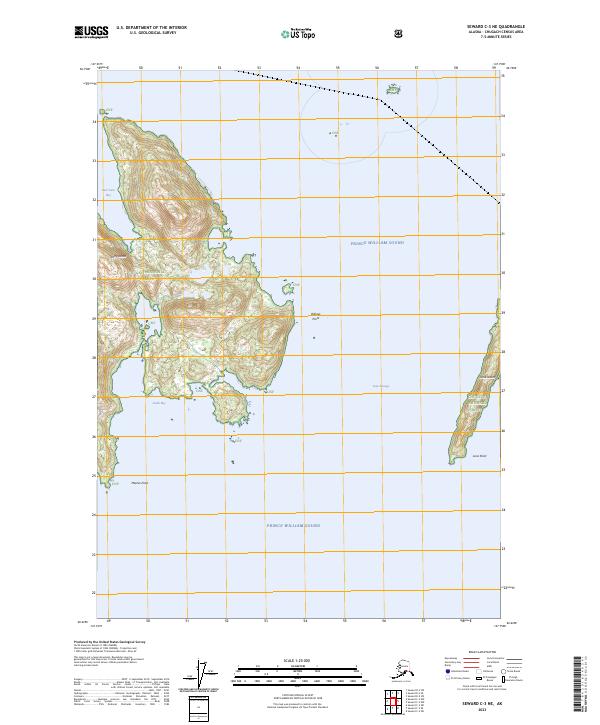
2023 Map of Seward C-3 NE
USGS Topo · Published 2023About this map
Perry Island dominates the western half of this maritime survey, its irregular coastline defined by East Twin Bay to the north and South Bay to the south. Located within the Chugach National Forest, the island's steep, glaciated terrain rises sharply from the cold waters of Prince William Sound. The eastern portion of the sheet captures the narrow north-south profile of Lone Island, separated from its larger neighbor by the deep waters of Lone Passage. Coastal navigation is marked by prominent landmarks such as Billings Point on the eastern shore of Perry Island and Meares Point to the south. This modern topographic record illustrates the intricate shoreline and extreme elevation changes characteristic of this coastal wilderness, where land and sea are tightly interlaced.
Find a feature on this map
16 named features on this map. Tap any name to fly to it.
Don’t see what you’re looking for? This feature index may not catch every label — zoom into the map to look around manually.
Map Details
Editions of this 2023 Seward C-3 NE Map
This is the sole edition of this map. No revisions or reprints were ever made.
Other maps of this area

1951 · Seward
USGS Topo · 1:250,000

1951 · Seward D-2
USGS Topo · 1:63,360

1951 · Seward D-3
USGS Topo · 1:63,360

1951 · Seward C-3
USGS Topo · 1:63,360

1951 · Seward C-2
USGS Topo · 1:63,360

1952 · Seward D-3
USGS Topo · 1:63,360

1952 · Seward C-3
USGS Topo · 1:63,360

1952 · Seward C-2
USGS Topo · 1:63,360

1952 · Seward D-2
USGS Topo · 1:63,360

1953 · Seward
USGS Topo · 1:250,000