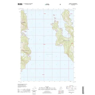
2018 Map of Seward C-3 NW
USGS Topo · Published 2018About this map
Prince William Sound dominates this coastal survey, where the deep waters of Perry Passage separate the mainland from the rugged eastern shore of Culross Island. This maritime landscape, protected within the Chugach National Forest, is defined by a complex network of bays and points accessible only by water. The map traces the intricate coastline from the secluded Hidden Bay in the west to the prominent headlands of Tipping Point and Bush Point in the center of the sheet. These geographic features highlight the navigational challenges and natural harbors that have historically supported seasonal fishing and maritime travel in this portion of the Alaska-Valdez-Cordova Census Area. To the east, West Twin Bay provides another sheltered inlet against the forested terrain, illustrating the dramatic intersection of sea and land that characterizes the Chugach region.
Find a feature on this map
14 named features on this map. Tap any name to fly to it.
Don’t see what you’re looking for? This feature index may not catch every label — zoom into the map to look around manually.
Map Details
Editions of this 2018 Seward C-3 NW Map
This is the sole edition of this map. No revisions or reprints were ever made.
Other maps of this area

1951 · Seward
USGS Topo · 1:250,000

1951 · Seward D-4
USGS Topo · 1:63,360

1951 · Seward D-3
USGS Topo · 1:63,360

1951 · Seward C-4
USGS Topo · 1:63,360

1951 · Seward C-3
USGS Topo · 1:63,360

1952 · Seward D-3
USGS Topo · 1:63,360

1952 · Seward C-3
USGS Topo · 1:63,360

1952 · Seward D-4
USGS Topo · 1:63,360

1952 · Seward C-4
USGS Topo · 1:63,360

1953 · Seward
USGS Topo · 1:250,000