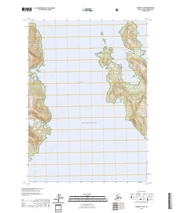
2023 Map of Seward C-3 NW
USGS Topo · Published 2023About this map
Prince William Sound dominates this coastal survey, where the deep waters of Perry Passage separate the mainland from the prominent landmass of Culross Island. The landscape is entirely contained within the Chugach National Forest, characterized by steep coastal topography and intricate shorelines. Several maritime landmarks provide orientation for navigation and study, including the sheltered waters of West Twin Bay and Hidden Bay.
Find a feature on this map
14 named features on this map. Tap any name to fly to it.
Don’t see what you’re looking for? This feature index may not catch every label — zoom into the map to look around manually.
Map Details
Editions of this 2023 Seward C-3 NW Map
This is the sole edition of this map. No revisions or reprints were ever made.
Other maps of this area

1951 · Seward
USGS Topo · 1:250,000

1951 · Seward D-4
USGS Topo · 1:63,360

1951 · Seward D-3
USGS Topo · 1:63,360

1951 · Seward C-4
USGS Topo · 1:63,360

1951 · Seward C-3
USGS Topo · 1:63,360

1952 · Seward D-3
USGS Topo · 1:63,360

1952 · Seward C-3
USGS Topo · 1:63,360

1952 · Seward D-4
USGS Topo · 1:63,360

1952 · Seward C-4
USGS Topo · 1:63,360

1953 · Seward
USGS Topo · 1:250,000