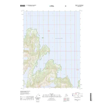
2023 Map of Seward C-3 SW
USGS Topo · Published 2023About this map
Chugach National Forest encompasses the wild, glacial terrain of the Kenai Peninsula along the western edge of Prince William Sound. This coastal landscape is defined by deep inlets and narrow bays, most notably Main Bay and Foul Bay, where the steep coastal mountains meet the sea. The geography here is shaped by active glacial presence, evidenced by the Isina Glacier which descends toward the southern shoreline near Falls Lake.
Find a feature on this map
12 named features on this map. Tap any name to fly to it.
Don’t see what you’re looking for? This feature index may not catch every label — zoom into the map to look around manually.
Map Details
Editions of this 2023 Seward C-3 SW Map
This is the sole edition of this map. No revisions or reprints were ever made.
Other maps of this area

1950 · Seward B-3
USGS Topo · 1:63,360

1951 · Seward
USGS Topo · 1:250,000

1951 · Seward B-4
USGS Topo · 1:63,360

1951 · Seward C-4
USGS Topo · 1:63,360

1951 · Seward C-3
USGS Topo · 1:63,360

1952 · Seward B-4
USGS Topo · 1:63,360

1952 · Seward B-3
USGS Topo · 1:63,360

1952 · Seward C-3
USGS Topo · 1:63,360

1952 · Seward C-4
USGS Topo · 1:63,360

1953 · Seward
USGS Topo · 1:250,000