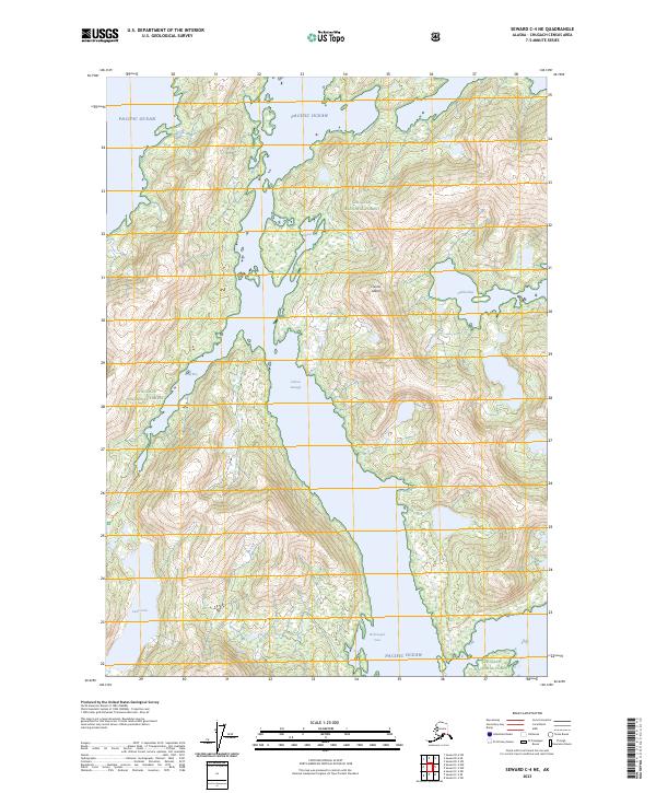
2023 Map of Seward C-4 NE
USGS Topo · Published 2023About this map
Culross Island dominates this 2023 survey of Prince William Sound's northern reaches, set within the protected boundaries of the Chugach National Forest. The map details a complex maritime landscape where the waters of the Pacific Ocean reach inland through deep-water inlets. Significant coastal features like Goose Bay and Hidden Bay are etched into the island's eastern shore, while the narrow Culross Passage separates the island from the mainland to the west. This topographic record emphasizes the isolation and water-dependent nature of the region, where Long Bay and Picturesque Cove serve as markers for navigation. The presence of Lake Jack on the western mainland illustrates the transition from saltwater coastlines to the high-elevation freshwater systems of the Alaska coast.
Find a feature on this map
18 named features on this map. Tap any name to fly to it.
Don’t see what you’re looking for? This feature index may not catch every label — zoom into the map to look around manually.
Map Details
Editions of this 2023 Seward C-4 NE Map
This is the sole edition of this map. No revisions or reprints were ever made.
Other maps of this area

1951 · Seward
USGS Topo · 1:250,000

1951 · Seward D-4
USGS Topo · 1:63,360

1951 · Seward D-3
USGS Topo · 1:63,360

1951 · Seward C-4
USGS Topo · 1:63,360

1951 · Seward C-3
USGS Topo · 1:63,360

1952 · Seward D-3
USGS Topo · 1:63,360

1952 · Seward C-3
USGS Topo · 1:63,360

1952 · Seward D-4
USGS Topo · 1:63,360

1952 · Seward C-4
USGS Topo · 1:63,360

1953 · Seward
USGS Topo · 1:250,000