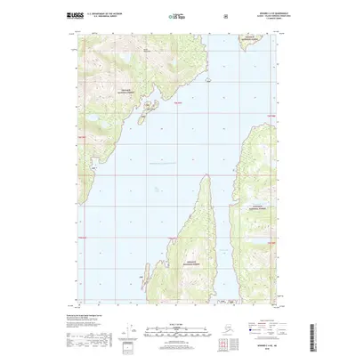
2018 Map of Seward C-4 SE
USGS Topo · Published 2018About this map
Prince William Sound dominates this coastal survey, where the saltwater reaches deep into the eastern edge of the Kenai Peninsula. The landscape is defined by the steep, forested slopes of the Chugach National Forest, which covers the rugged interior terrain and fragmented islands. This 2018 topographic study illustrates the intricate interface between sea and land, particularly around the sheltered waters of Port Nellie Juan. The geography is characterized by high-elevation lakes like Cheimoviski Lake and small outcrops such as Mink Island, which stand as landmarks in an area with no established road network or permanent settlements. The map provides a detailed view of the natural contours and hydrologic patterns of the Chugach wilderness before modern development reached these remote shores.
Find a feature on this map
13 named features on this map. Tap any name to fly to it.
Don’t see what you’re looking for? This feature index may not catch every label — zoom into the map to look around manually.
Map Details
Editions of this 2018 Seward C-4 SE Map
This is the sole edition of this map. No revisions or reprints were ever made.
Other maps of this area

1950 · Seward B-3
USGS Topo · 1:63,360

1951 · Seward
USGS Topo · 1:250,000

1951 · Seward B-4
USGS Topo · 1:63,360

1951 · Seward C-4
USGS Topo · 1:63,360

1951 · Seward C-3
USGS Topo · 1:63,360

1952 · Seward B-4
USGS Topo · 1:63,360

1952 · Seward B-3
USGS Topo · 1:63,360

1952 · Seward C-3
USGS Topo · 1:63,360

1952 · Seward C-4
USGS Topo · 1:63,360

1953 · Seward
USGS Topo · 1:250,000