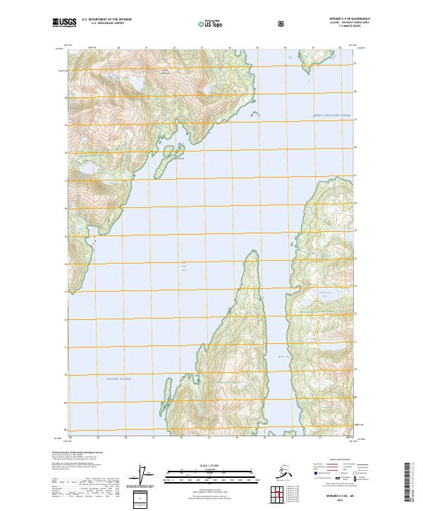
2023 Map of Seward C-4 SE
USGS Topo · Published 2023About this map
The Kenai Peninsula coastline meets the northern reaches of the Pacific Ocean in this coastal Alaskan study, focusing on the intricate waterways of Prince William Sound. This region within the Chugach National Forest is defined by steep glacial-carved terrain and sheltered deep-water inlets. Significant maritime features include Port Nellie Juan and the long, narrow reach of McClure Bay. The map records a wilderness landscape where terrestrial life is concentrated on small landmasses like Mink Island or nestled near freshwater sources such as Cheimoviski Lake. The absence of roads or developed settlements highlights the isolation of this corner of the sound, reachable primarily by sea, where the interaction between the high coastal peaks and the tide-dominated shoreline remains the primary geographical narrative.
Find a feature on this map
14 named features on this map. Tap any name to fly to it.
Don’t see what you’re looking for? This feature index may not catch every label — zoom into the map to look around manually.
Map Details
Editions of this 2023 Seward C-4 SE Map
This is the sole edition of this map. No revisions or reprints were ever made.
Other maps of this area

1950 · Seward B-3
USGS Topo · 1:63,360

1951 · Seward
USGS Topo · 1:250,000

1951 · Seward B-4
USGS Topo · 1:63,360

1951 · Seward C-4
USGS Topo · 1:63,360

1951 · Seward C-3
USGS Topo · 1:63,360

1952 · Seward B-4
USGS Topo · 1:63,360

1952 · Seward B-3
USGS Topo · 1:63,360

1952 · Seward C-3
USGS Topo · 1:63,360

1952 · Seward C-4
USGS Topo · 1:63,360

1953 · Seward
USGS Topo · 1:250,000