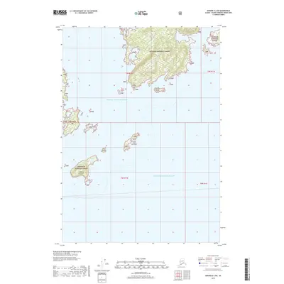
2018 Map of Seward D-2 SW
USGS Topo · Published 2018About this map
Chugach National Forest land dominates the northern and western reaches of this maritime landscape in Prince William Sound. The geography is defined by a series of significant coastal islands and isolated points, including Kiniklik Island and the jagged profile of Point Pellew at the forest's edge. To the south, the archipelago continues with Little Axel Lind Island and the larger Axel Lind Island, separated from the mainland by deep coastal waters. This 2018 survey by the U.S. Geological Survey provides a precise view of the shorelines and topography of the Unorganized Borough, from the sheltered waters of Olsen Cove to the scattered outcrops of the Jenny Islands. The map illustrates the minimal human infrastructure in this region, focusing instead on the complex coastal interface of Eaglek Island and the protected wilderness boundaries.
Find a feature on this map
15 named features on this map. Tap any name to fly to it.
Don’t see what you’re looking for? This feature index may not catch every label — zoom into the map to look around manually.
Map Details
Editions of this 2018 Seward D-2 SW Map
This is the sole edition of this map. No revisions or reprints were ever made.
Other maps of this area

1951 · Seward
USGS Topo · 1:250,000

1951 · Seward D-2
USGS Topo · 1:63,360

1951 · Seward D-3
USGS Topo · 1:63,360

1951 · Seward C-3
USGS Topo · 1:63,360

1951 · Seward C-2
USGS Topo · 1:63,360

1952 · Seward D-3
USGS Topo · 1:63,360

1952 · Seward C-3
USGS Topo · 1:63,360

1952 · Seward C-2
USGS Topo · 1:63,360

1952 · Seward D-2
USGS Topo · 1:63,360

1953 · Seward
USGS Topo · 1:250,000