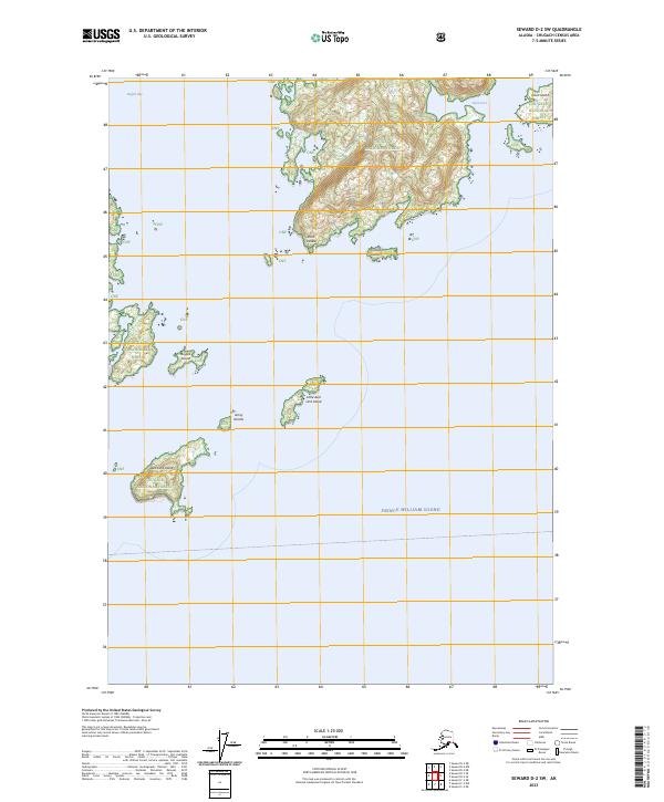
2023 Map of Seward D-2 SW
USGS Topo · Published 2023About this map
Prince William Sound defines the southern reaches of this coastal environment, where the deep waters of Eaglek Bay and Olsen Cove cut into the mountainous coastline. Much of the land area is protected as part of the Chugach National Forest, characterized by steep, glacially carved terrain and numerous islands. The map highlights a complex archipelago including Axel Lind Island, Olsen Island, and Kiniklik Island, offering a detailed view of the shoreline as it existed in the early 21st century.
Find a feature on this map
16 named features on this map. Tap any name to fly to it.
Don’t see what you’re looking for? This feature index may not catch every label — zoom into the map to look around manually.
Map Details
Editions of this 2023 Seward D-2 SW Map
This is the sole edition of this map. No revisions or reprints were ever made.
Other maps of this area

1951 · Seward
USGS Topo · 1:250,000

1951 · Seward D-2
USGS Topo · 1:63,360

1951 · Seward D-3
USGS Topo · 1:63,360

1951 · Seward C-3
USGS Topo · 1:63,360

1951 · Seward C-2
USGS Topo · 1:63,360

1952 · Seward D-3
USGS Topo · 1:63,360

1952 · Seward C-3
USGS Topo · 1:63,360

1952 · Seward C-2
USGS Topo · 1:63,360

1952 · Seward D-2
USGS Topo · 1:63,360

1953 · Seward
USGS Topo · 1:250,000