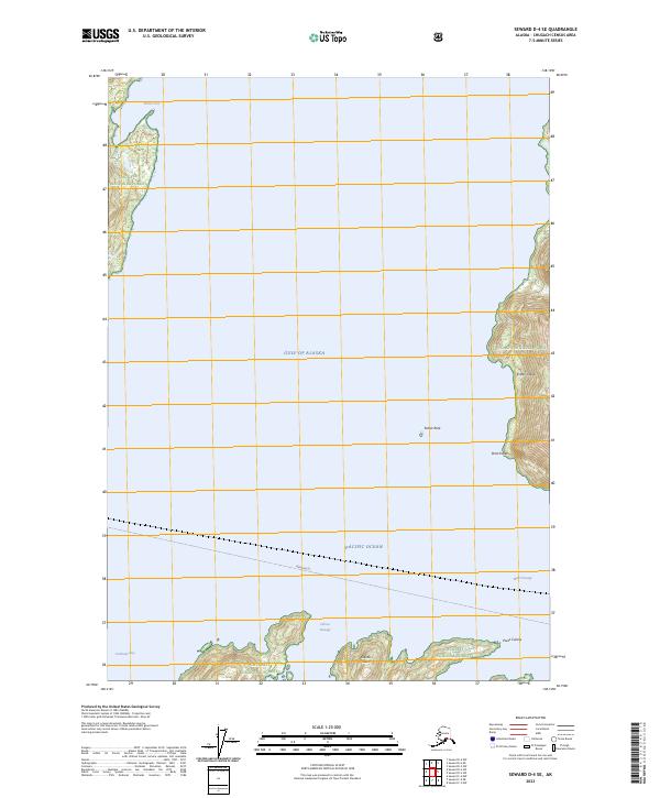
2023 Map of Seward D-4 SE
USGS Topo · Published 2023About this map
Chugach National Forest land meets the marine corridors of Prince William Sound in this coastal Alaskan study. The map tracks the jagged eastern shoreline of Esther Island, from the sheltered waters of Pirate Cove south past Point Esther. Further south, across the open expanse of the Gulf of Alaska and Pacific Ocean, the northern edge of Culross Island is visible, including Point Culross and the navigational waters of Culross Passage. A designated Ferry Route cuts across the deep waters of Wells Passage, illustrating the primary maritime transit path for travelers moving between the fjords. This survey provides a precise modern look at the relationship between steep forest terrain and the complex network of bays, such as Cochrane Bay, that define this remote coastal region.
Find a feature on this map
18 named features on this map. Tap any name to fly to it.
Don’t see what you’re looking for? This feature index may not catch every label — zoom into the map to look around manually.
Map Details
Editions of this 2023 Seward D-4 SE Map
This is the sole edition of this map. No revisions or reprints were ever made.
Other maps of this area

1951 · Seward
USGS Topo · 1:250,000

1951 · Seward D-4
USGS Topo · 1:63,360

1951 · Seward D-3
USGS Topo · 1:63,360

1951 · Seward C-4
USGS Topo · 1:63,360

1951 · Seward C-3
USGS Topo · 1:63,360

1952 · Seward D-3
USGS Topo · 1:63,360

1952 · Seward C-3
USGS Topo · 1:63,360

1952 · Seward D-4
USGS Topo · 1:63,360

1952 · Seward C-4
USGS Topo · 1:63,360

1953 · Seward
USGS Topo · 1:250,000