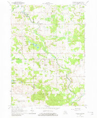
1964 Map of Sherman City
USGS Topo · Published 1982About this map
The Chippewa River winds through this central Michigan landscape, defining the local geography as it flows past settlements like Sherman City and Chippewa Vista. In the mid-1960s, this area on the border of Mecosta and Isabella counties supported a mix of small-scale agriculture and early industrial activity, evidenced by several Gravel Pits and an Oil Well near the river valley. The map documents a cluster of glacial lakes known as Six Lakes, including Strong Lake, Markel Lake, and Long Lake, which provided a natural focus for the rural townships of Coldwater, Sheridan, Wheatland, and Broomfield. Cultural markers of the era's community life are preserved through labels for the Forest Hill Ch, Sherman City Cem, and the small crossroads at Horr and Titus.
Find a feature on this map
39 named features on this map. Tap any name to fly to it.
Don’t see what you’re looking for? This feature index may not catch every label — zoom into the map to look around manually.
Map Details
Editions of this 1964 Sherman City Map
3 editions found

Other maps of this area

1916 · Mount Pleasant
USGS Topo · 1:62,500

1919 · Mount Pleasant
USGS Topo · 1:62,500

1943 · Mount Pleasant
USGS Topo · 1:62,500

1954 · Midland
USGS Topo · 1:250,000

1958 · Midland
USGS Topo · 1:250,000

1959 · Midland
USGS Topo · 1:250,000

1959 · Lake
USGS Topo · 1:62,500

1959 · Clare
USGS Topo · 1:62,500

1964 · Mecosta NW
USGS Topo · 1:24,000

1964 · Blanchard
USGS Topo · 1:24,000