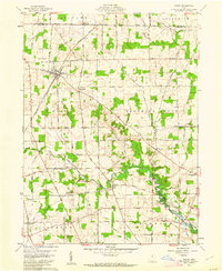
1960 Map of Shiloh
USGS Topo · Published 1962About this map
The village of Shiloh serves as a central hub on this 1960s survey, marking a significant intersection of the New York Central railroad and a grid of local roads. The landscape transition is evident where the northern agriculture of Ripley and Greenwich townships gives way to the winding course of the Black Fork Mohican River. Several small settlements, including Planktown, Ganges, and Rome, are scattered across the terrain, reflecting the area's rural development patterns.
Find a feature on this map
62 named features on this map. Tap any name to fly to it.
Don’t see what you’re looking for? This feature index may not catch every label — zoom into the map to look around manually.
Map Details
Editions of this 1960 Shiloh Map
4 editions found
Other maps of this area

1908 · Ashland
USGS Topo · 1:62,500

1908 · New London
USGS Topo · 1:62,500

1915 · Norwalk
USGS Topo · 1:62,500

1915 · Crestline
USGS Topo · 1:62,500

1943 · Crestline
USGS Topo · 1:62,500

1944 · Norwalk
USGS Topo · 1:62,500

1950 · Marion
USGS Topo · 1:250,000

1956 · Toledo
USGS Topo · 1:250,000

1960 · New London
USGS Topo · 1:24,000

1960 · Willard
USGS Topo · 1:24,000