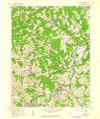
1960 Map of Shinnston
USGS Topo · Published 1962About this map
The West Fork River valley serves as the industrial and social corridor for this portion of Harrison and Marion counties at the start of the 1960s. The landscape is defined by the convergence of heavy rail and coal extraction, with the Baltimore and Ohio and Western Maryland railroads threading through narrow hollows to reach significant mining operations. Industrial features like the Pumping Station near Lumberport and the Filtration Plant at Shinnston anchor the riverfront, while the surrounding hills are marked by numerous Strip Mine sites and Mine Dump areas.
Find a feature on this map
67 named features on this map. Tap any name to fly to it.
Don’t see what you’re looking for? This feature index may not catch every label — zoom into the map to look around manually.
Map Details
Editions of this 1960 Shinnston Map
3 editions found
Other maps of this area

1902 · Clarksburg
USGS Topo · 1:62,500

1902 · Fairmont
USGS Topo · 1:62,500

1904 · Blacksville
USGS Topo · 1:62,500

1905 · Mannington
USGS Topo · 1:62,500

1910 · Clarksburg
USGS Topo · 1:62,500

1923 · Blacksville
USGS Topo · 1:62,500

1923 · Fairmont
USGS Topo · 1:62,500

1923 · Mannington
USGS Topo · 1:62,500

1923 · Clarksburg
USGS Topo · 1:62,500

1925 · Blacksville
USGS Topo · 1:62,500