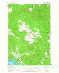
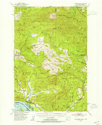
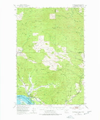
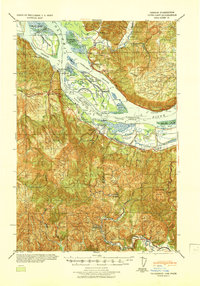
1953 Map of Skamokawa
USGS Topo · Published 1965About this map
Skamokawa sits at the northern edge of the Columbia River, serving as a focal point for the timber and river-based economy of Wahkiakum County in the early 1950s. The landscape is defined by the steep drainage of the Grays River and Skamokawa Creek, where the transition from tide-influenced lowlands to high ridgelines like Long Ridge is immediate. The infrastructure of the logging industry is clearly etched across the hills, with numerous logging roads and remnants of older transport networks including a Dismantled RR and an Abandoned RR winding through the timber tracts. Along the riverfront, the presence of Fishhouses and the Skamokawa Channel highlight the area's maritime reliance. On the landward side, family roots are grounded at the Fern Hill Cem and small settlements like Fern Hill, while the higher elevations are marked by utilitarian outposts such as the Blaney Lookout.
Find a feature on this map
67 named features on this map. Tap any name to fly to it.
Don’t see what you’re looking for? This feature index may not catch every label — zoom into the map to look around manually.
Map Details
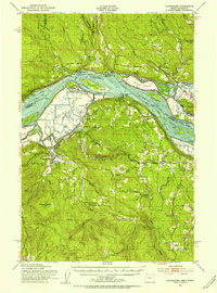
Editions of this 1953 Skamokawa Map
Other maps of this area

1919 · Mayger
USGS Topo · 1:62,500
1940 · Svensen
USGS Topo · 1:62,500

1940 · Brookfield
USGS Topo · 1:62,500

1941 · Walville
USGS Topo · 1:62,500

1941 · Meskill
USGS Topo · 1:62,500

1941 · Skamokawa
USGS Topo · 1:62,500

1941 · Clatskanie
USGS Topo · 1:62,500
1941 · Cathlamet
USGS Topo · 1:62,500
1952 · Clatskanie
USGS Topo · 1:62,500

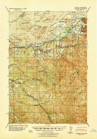
1953 · Hoquiam
USGS Topo · 1:250,000