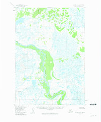
1954 Map of Sleetmute C-1
USGS Topo · Published 1961About this map
The Stony River meanders through a vast expanse of wetlands and muskeg in this mid-century survey of the Alaska interior. The landscape is defined by its complex hydrology, where the main river channel is fed by numerous smaller tributaries including Black Creek and Muskeg Creek. Surveyed in the 1950s, the map reveals a wilderness largely untouched by development, with land lines representing unsurveyed and unmarked locations predetermined by the Bureau of Land Management. Navigation and orientation in this water-heavy terrain relied on specific high points, such as VABM 824 Lonely and VABM 573 Lucky, which stood out against the low-lying marshes. The presence of Stink R in the southern portion of the sheet further illustrates the intricate drainage patterns of the Seward Meridian.
Find a feature on this map
6 named features on this map. Tap any name to fly to it.
Don’t see what you’re looking for? This feature index may not catch every label — zoom into the map to look around manually.
Map Details
Editions of this 1954 Sleetmute C-1 Map
2 editions found
Other maps of this area

1950 · Sleetmute
USGS Topo · 1:250,000

1951 · Lime Hills
USGS Topo · 1:250,000

1954 · Sleetmute D-1
USGS Topo · 1:63,360

1954 · Sleetmute C-2
USGS Topo · 1:63,360

1954 · Sleetmute C-1
USGS Topo · 1:63,360

1954 · Sleetmute D-2
USGS Topo · 1:63,360
1954 · Lime Hills D-8
USGS Topo · 1:63,360

1954 · Sleetmute
USGS Topo · 1:250,000

1954 · Sleetmute B-2
USGS Topo · 1:63,360

1954 · Lime Hills B-8
USGS Topo · 1:63,360