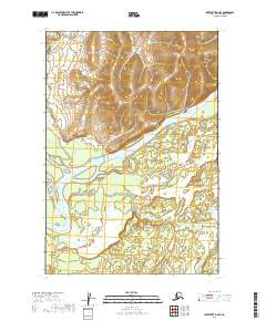
2019 Map of Sleetmute D-2 SE
USGS Topo · Published 2019About this map
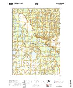
The Kuskokwim River dominates the center of this 2019 survey, cutting a wide path through the Bethel Census Area. This stretch of the river illustrates the dynamic hydrology of the Alaskan interior, showing complex island formations and expansive wetlands that have shaped movement and subsistence in the region for generations. The topography transitions from the low-lying river basin to elevated ridges in the north, where sharp contour lines define the rising terrain. Detailed township and range lines, such as t21n r40w and t20n r39w, provide the essential legal framework for land management in this remote section of the Kuskokwim valley.
Find a feature on this map
7 named features on this map. Tap any name to fly to it.
Don’t see what you’re looking for? This feature index may not catch every label — zoom into the map to look around manually.
Map Details
Editions of this 2019 Sleetmute D-2 SE Map
This is the sole edition of this map. No revisions or reprints were ever made.
Other maps of this area

1950 · Sleetmute
USGS Topo · 1:250,000

1954 · Sleetmute D-1
USGS Topo · 1:63,360

1954 · Sleetmute C-2
USGS Topo · 1:63,360

1954 · Sleetmute C-1
USGS Topo · 1:63,360

1954 · Sleetmute D-2
USGS Topo · 1:63,360

1954 · Sleetmute
USGS Topo · 1:250,000
2019 · Sleetmute D-2 NW
USGS Topo · 1:25,000
2019 · Sleetmute D-2 SW
USGS Topo · 1:25,000
2019 · Sleetmute D-1 SW
USGS Topo · 1:25,000
2019 · Sleetmute C-2 NE
USGS Topo · 1:25,000