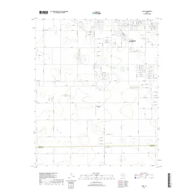
2019 Map of Slide
USGS Topo · Published 2019About this map
The expanding southwestern reach of Lubbock dominates this survey, showing a landscape defined by its transition from high plains agriculture to residential development. The city's grid is documented through thorough labeling of major arteries like Quaker Ave, Frankford Ave, and Indiana Ave, alongside numerous numbered streets that push into the surrounding countryside. A notable landmark in the central portion of the sheet is Remembrance Airport, positioned amidst the open terrain before reaching the southern boundary between Lubbock Co and Lynn Co. This documentation of the area at the close of the 2010s captures the specific layout of roads and neighborhood boundaries during a period of steady growth, providing a clear reference for the suburban topography of the South Plains.
Find a feature on this map
112 named features on this map. Tap any name to fly to it.
Don’t see what you’re looking for? This feature index may not catch every label — zoom into the map to look around manually.
Map Details
Editions of this 2019 Slide Map
This is the sole edition of this map. No revisions or reprints were ever made.
Other maps of this area

1954 · Lubbock
USGS Topo · 1:250,000

1954 · Brownfield
USGS Topo · 1:250,000

1957 · Lubbock East
USGS Topo · 1:24,000

1957 · New Home
USGS Topo · 1:62,500

1957 · Lubbock West
USGS Topo · 1:24,000

1957 · Lubbock
USGS Topo · 1:62,500

1957 · Meadow
USGS Topo · 1:62,500

1957 · Wolfforth
USGS Topo · 1:62,500

1958 · Brownfield
USGS Topo · 1:250,000

1962 · Brownfield
USGS Topo · 1:250,000