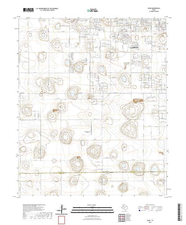
2022 Map of Slide
USGS Topo · Published 2022About this map
The southern outskirts of Lubbock and the surrounding agricultural plains of the Llano Estacado define this modern survey. The map records a landscape in transition, where the grid of the city meets the expansive farm and ranch lands of the Texas Panhandle. A primary landmark in this rural-urban interface is Remembrance Airport, situated amidst a network of section roads like Upland Ave and Juneau Ave. The terrain is punctuated by numerous small depressions and playas, characteristic of the region's geography. Along the southern edge, the boundary between Lubbock Co and Lynn Co is clearly demarcated, crossing through open country near Willow Rd. The road network, including Woodrow Rd and a sequence of numbered streets and county roads, illustrates the systematic development of this semi-arid plateau.
Find a feature on this map
118 named features on this map. Tap any name to fly to it.
Don’t see what you’re looking for? This feature index may not catch every label — zoom into the map to look around manually.
Map Details
Editions of this 2022 Slide Map
This is the sole edition of this map. No revisions or reprints were ever made.
Other maps of this area

1954 · Lubbock
USGS Topo · 1:250,000

1954 · Brownfield
USGS Topo · 1:250,000

1957 · Lubbock East
USGS Topo · 1:24,000

1957 · New Home
USGS Topo · 1:62,500

1957 · Lubbock West
USGS Topo · 1:24,000

1957 · Lubbock
USGS Topo · 1:62,500

1957 · Meadow
USGS Topo · 1:62,500

1957 · Wolfforth
USGS Topo · 1:62,500

1958 · Brownfield
USGS Topo · 1:250,000

1962 · Brownfield
USGS Topo · 1:250,000