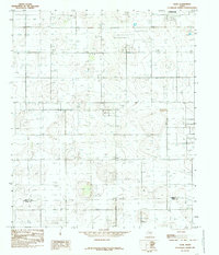
1985 Map of Slide
USGS Topo · Published 1985About this map
Slide occupies a landscape characterized by an extensive grid of irrigation and extraction, situated on the plateau south of Lubbock. This mid-1980s provisional survey illustrates a highly utilized rural territory where the border between Lubbock Co and Lynn Co cuts through a dense concentration of wells. The infrastructure of the Llano Estacado is on full display, from the industrial presence of 3 Storage Bins and a Radio Tower to the utilitarian corrals that reflect the area's agricultural heritage.
Find a feature on this map
10 named features on this map. Tap any name to fly to it.
Don’t see what you’re looking for? This feature index may not catch every label — zoom into the map to look around manually.
Map Details
Editions of this 1985 Slide Map
This is the sole edition of this map. No revisions or reprints were ever made.
Other maps of this area

1954 · Lubbock
USGS Topo · 1:250,000

1954 · Brownfield
USGS Topo · 1:250,000

1957 · Lubbock East
USGS Topo · 1:24,000

1957 · New Home
USGS Topo · 1:62,500

1957 · Lubbock West
USGS Topo · 1:24,000

1957 · Lubbock
USGS Topo · 1:62,500

1957 · Meadow
USGS Topo · 1:62,500

1957 · Wolfforth
USGS Topo · 1:62,500

1958 · Brownfield
USGS Topo · 1:250,000

1962 · Brownfield
USGS Topo · 1:250,000