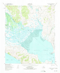
1950 Map of Solomon C-3
USGS Topo · Published 1975About this map
Golovnin Lagoon and the surrounding coastal tundra of the Seward Peninsula appear here during a mid-century era of remote transport and communication. The landscape is defined by the massive delta of the Fish River and Mudyutok River, where intricate waterways meet the tidal flats. Settlement is sparse, focused on small outposts like White Mountain and the coastal village of Golovin (Cheenik).
Find a feature on this map
27 named features on this map. Tap any name to fly to it.
Don’t see what you’re looking for? This feature index may not catch every label — zoom into the map to look around manually.
Map Details
Editions of this 1950 Solomon C-3 Map
3 editions found
Other maps of this area

1950 · Solomon B-3
USGS Topo · 1:63,360

1950 · Solomon B-2
USGS Topo · 1:63,360

1950 · Solomon C-4
USGS Topo · 1:63,360

1950 · Solomon D-2
USGS Topo · 1:63,360

1950 · Solomon C-2
USGS Topo · 1:63,360

1950 · Solomon D-3
USGS Topo · 1:63,360

1950 · Solomon
USGS Topo · 1:250,000

1950 · Solomon C-3
USGS Topo · 1:63,360

1950 · Solomon D-4
USGS Topo · 1:63,360

1951 · Solomon
USGS Topo · 1:250,000