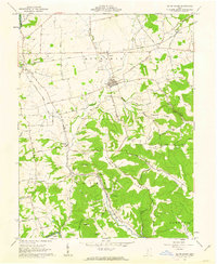
1961 Map of South Salem
USGS Topo · Published 1963About this map
The village of South Salem anchors this 1961 survey, revealing a landscape defined by the drainage systems of Buckskin Creek and Paint Creek as they cut through the Ross and Highland County border. This era shows the local infrastructure of western Ross County before the widespread consolidation of rural sites, including the Township Sch and multiple family-named burial grounds like Satchel Cem and Nuckols Cem.
Find a feature on this map
56 named features on this map. Tap any name to fly to it.
Don’t see what you’re looking for? This feature index may not catch every label — zoom into the map to look around manually.
Map Details
Editions of this 1961 South Salem Map
3 editions found
Other maps of this area

1912 · Roxabell
USGS Topo · 1:62,500

1914 · Roxabell
USGS Topo · 1:62,500

1915 · Bainbridge
USGS Topo · 1:48,000

1915 · Piketon
USGS Topo · 1:62,500

1917 · Bainbridge
USGS Topo · 1:62,500

1917 · Piketon
USGS Topo · 1:62,500

1917 · Greenfield
USGS Topo · 1:62,500

1944 · Piketon
USGS Topo · 1:62,500

1944 · Greenfield
USGS Topo · 1:62,500

1944 · Roxabell
USGS Topo · 1:62,500